Monday Tuesday Today we finished the notes and created a political map (see below for map features) Click Read more for list of identification
0 Comments
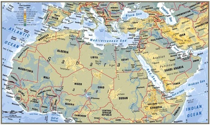 Today we learned about the physical features of north africa and southwest asia by taking teacher generated notes and creating a physical map of the region.
To get notes, click here Steps: 1. students get a blank sheet of paper 2. students label their todals 3. students draw the borders of north africa and south west asia 4. students identify the following terms: 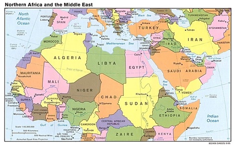 today students learned about the political entities that make up North Africa and southwest Asia by completing a political map. Click the file below to get the instructions and the map. Only complete the cities underlined and the countries.
Map and Notes
|
Categories
All
|
||||||||
 RSS Feed
